Home >
Crater Lake National Park, Oregon, United States
Photos of Crater Lake National
Park,
Oregon
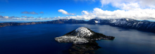
Crater Lake was formed by a volcanic eruption over 7,000 years ago
that left a deep basin where the mountain peak once stood. The
Lake is over 1,900 ft deep and is the deepest lake in the US. It
stands at 6,170 ft above sea level surrounded by mountain peaks as high
as 8,900 ft.
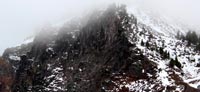
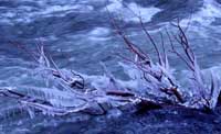
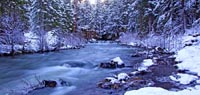
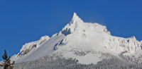
I arrived at Crater Lake National Park, Oregon the day after 4 inches of snow fell,
in October. The weather in the days following the snowfall were wet,
wild and windy; it was exciting to be there.
I am looking forward
with anticipation to returning to this wild, untamed place as soon as
more snow falls.